This 17 minute video was included as a projection in our exhibition at Wollongong Art Gallery in November 2017.
The video was commissioned by us, and produced by cinematographer Hayden Griffiths from Phoenix Media.
The first part of the video shows a continuous aerial “scan” from the mouth of Allans Creek at the Port Kembla Steelworks, all the way through the suburbs where Allans Creek merges with Byarong Creek, and up into the escarpment.
The second part of the video is a selection of drone footage from various parts of Byarong Creek.
In the lead up to our exhibition at Wollongong Art Gallery, we have been trying to learn more about some of the Aboriginal stories of the local creeks.
As part of our project, there will be a tour with Les Bursill in late January. Les is a Dharawal historian, archaeologist, anthropologist, and publisher, and he will walk with us up Ooaree Creek (near Gerringong), details here.
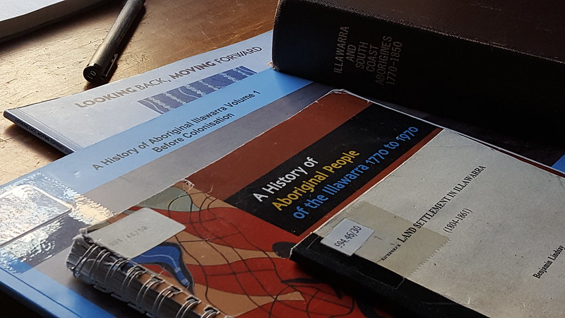
In the meantime, we thought it would be a good idea to have a look at some of the books that have been published about the histories of the Illawarra, to see what we could find about Aboriginal relationships to the waterways.
For this task, our friend, the artist Clementine Barnes took on the job of archival researcher. Here is a brief account of what she learned from some of the books that are available at the University of Wollongong library:
Aboriginal Histories of the Waterways of the Illawarra.
– Some notes by Clementine Barnes
Researching Indigenous Australian histories is a challenge. Many of the available documents explaining the history of the Illawarra region and the changes brought about by European colonisation merely ripple the surface, and a murky one at that.
Lucas met me at Central Station one morning a few months back and gave me a heavy bag of books. Subsequently, I set about reading each book from cover to cover in the hope of finding something of substance. The main thing I am left with from my research is the reality that Indigenous Australians do not record natural histories in the same way as the Colonials who invaded so-called ‘terra nullius’.
My blog post is a bit of a miscellany of things I find noteworthy or relevant. It is my hope that others who read this will be able to share some interesting insights into the Waterways of the Illawarra (WOTI) so that this digital space will consequently become a creative common of information on the WOTI.
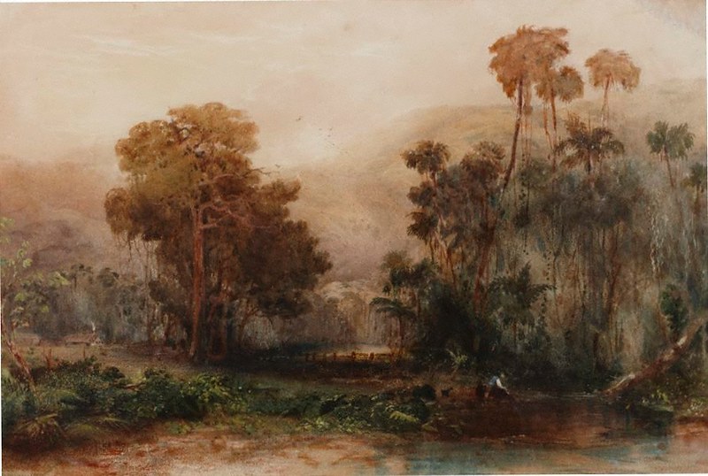
Artists including Augustus Earle, Conrad Martens, John Skinner Prout, George French Angas, Eugene von Guérard, Nicholas Chevalier and were some of the first European artists to venture to the ‘south side’ to document the natural environment of the Illawarra region [1], yet as you can see in the images included with this blog post, their view shows a romanticised, picturesque landscape – an amalgamation of natural and introduced species.
“Illawarra (early 1850s)”, by Conrad Martens, Watercolour, Art Gallery of New South Wales Image credit: https://www.artgallery.nsw.gov.au/collection/works/4378/“A fig tree on American Creek near Wollongong”, NSW, Eugene von Guérard, 1861, Oil on Canvas, Art Gallery of New South Wales Image credit: https://www.artgallery.nsw.gov.au/collection/works/398.1996/“Illawarra”, by Conrad Martens, Watercolour, Art Gallery of New South Wales Image credit: https://www.artgallery.nsw.gov.au/collection/works/115/
I read in the publication A history of Aboriginal Illawarra Volume 1 Before Colonisation, written by Mike Donaldson, Les Bursill and Mary Jacobs, that the two major Indigenous groups of the Illawarra region were the Dharawal and the Dhurga. The Dharawal clans spoke one language, the Dhurga spoke several different dialects. ‘Dharawal people are distinguished as fresh water, bitter water or salt water people depending on whether they occupied the coastal regions, the swamps of the plateaus and inland river valleys’ [2].
The waterways, rivers, lakes and coastal waters of the Illawarra were important sources of food and spiritual significance and like most ‘early settler’ stories, the first European invaders would not have survived without the assistance of intimate Indigenous knowledge of the region. Merriman Island in the middle of Wallaga Lake – is ‘Umbarra’, the black duck – the totem of the Yuin nation: “Totems play an important part in daily life, affecting with whom people could associate, the ceremonies they could or could not perform and attend, and what they could harvest and eat” [3].
It has been interesting for me to learn about totems and the beliefs surrounding them, something I didn’t know much about before, having spent the majority of my school years in New Zealand. It’s a poor excuse, seeing as I have spent the better part of my adult life in Australia and I wonder why it is that I didn’t know more about this before now.
I find totems interesting as they reiterate the interconnectedness of Aboriginal culture. This has been an opportunity for me to learn why colonial perspectives were so at odds with the Indigenous World View – as demonstrated in the 1880s, when the colonial government decided that many of the animals vital to the life force of Indigenous Australians were noxious.
The Waterways of the Illawarra today would be unrecognisable to the early Indigenous community due to a few different factors. Many middens were destroyed in the 1860s to make lime and would consequently give Shellharbour its name. “The public camping grounds at Bulli and Windang are sited on middens and at Port Kembla one midden runs 600 meters and takes in Boiler’s Point and the Northern End of North Beach” [4].
This is nothing new in the history of colonisation – a tailoring of the landscape to make way for ‘progress’. This alteration, evident on a physical level through the construction of dams, weirs, fish traps, the bridging of streams and through the construction of roads and railways – impacted the waterways of the Illawarra, modifying the structure of the bird and fish life, carving into and covering over Indigenous song lines, dreaming tracks and personal histories.
There is some sort of strange irony in the fact that many camping grounds in the Illawarra region sit on these middens – sites of Indigenous history now inhabited by temporary dwellers and dwellings.
3 A history of Aboriginal Illawarra Volume 1 Before Colonisation, by Mike Donaldson, Les Bursill and Mary Jacobs, 2015, http://ro.uow.edu.au/asdpapers/581/
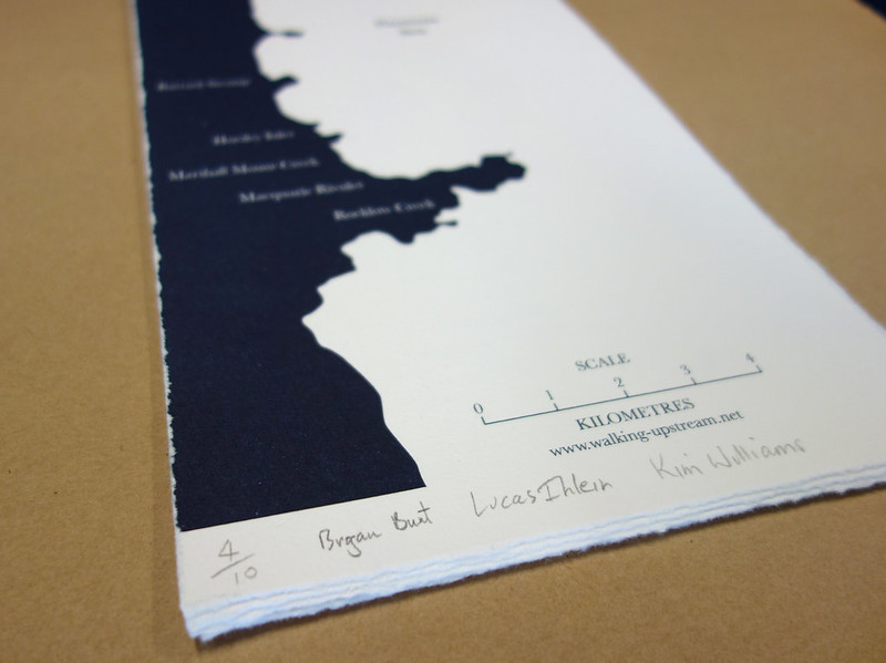
The beautiful WOTI publication we recently printed at Big Fag Press is now available. We’ve been calling it a “broadsheet”, but really it’s a narrowsheet. 12 pages of creek walking goodness, some hand-drawn maps, poems, stories, a sort of manifesto, and even leech cartoons.
We have plenty of copies printed on IMPACT recycled paper 250gsm, which we are happy to give away to interested parties (you pay the postage) – just send us an email (info@walking-upstream.net).
And of course, you’ll definitely be handed one when you come on a creek walk with us!
We’re all off to Melbourne this week, to present Waterways of the Illawarra for an exhibition at Margaret Lawrence Gallery, VCA. It’s all part of the Performing Mobilities program.
Doing a gallery talk on Saturday at Margaret Lawrence Gallery Sat 10 Oct, 2pm-330pm
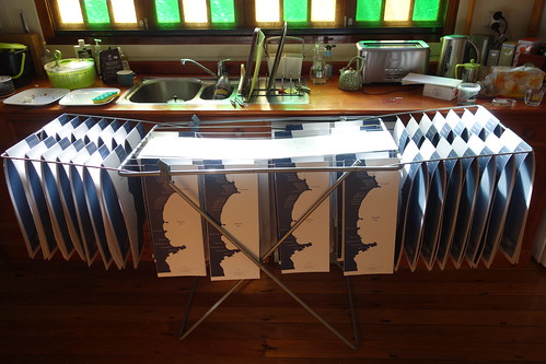
We’ve produced a beautiful new broadsheet on the Big Fag Press for the occasion, which offers some highlights from the WOTI blog, as well as new material. Here are some production shots. Design is by John Causley.
2pm Saturday and I am writing exactly one week after setting out to walk upstream, a week in which much rain has flowed. This creek apparently passes through the town’s fenced-off major steel works site before entering the sea, so we start at a nearby more accessible location a little upstream, the Figtree Westfield Shopping Centre. Amongst common brands, materials of cool efficiency, controlled air and lighting systems, I scan for a drink fountain from which to fill my bottle, wondering what relation such waters might hold to the creek I am yet to meet. Walking and no fountain found. Gliding over terrazzo-like surfaces, past display counters and back-lit plastic signage, through shadowless spaces and a-temporal atmospheres, through automatic sliding doors to exit into the asphalt carpark, heading wests toward the escarpment onto a concrete road-side pavement that quickly delivers us to a small bridge. Now this must be the creek! Look left, look right, upstream and downstream. Byarong Creek! Look left, look right, choose your timing between traffic and cross this four lane coastal Princes Highway. The aura of consumer environments begins to fade, with exception of a stray beer can and confectionary wrapper here and there. Now it is all shades of green and brown and yellow tones with flickers of reds and blues from flowers and foliage. The four of us are walking upstream but I’m still wondering where the creek went down stream – past or under the shopping centre complex; on toward the steel factory, the management of which I am told espouses that the creek is good, so good that ‘there are sharks in it’. I presume that for the steelworks, the creek was once a dual-purpose source of water-cooling and a conduit for waste disposal, perhaps being originally sited near the creek mouth to the ocean for just such purpose. Maybe claiming there are sharks up the creek keeps some away from wanting to nose about? I only saw the behemoth shark of commodity capitalism where we started out from.
‘Now we are free’, I jest to myself, feeling like we are ‘walking upstream’ as I’d expected, but secretly now I’m primed for surprise and contradiction. Walking thin green strips beside the creek, along suburban roads and homes, past small tracks that dip down the small embankment to the waters edge, signs of children and dogs, and… . Really? I’m told there are wild deer that venture down from the escarpment woods at night. ‘Keep an eye out for that scat’ I note to self, trying on the diligent bushwalker. And where is that soapy liquid that she is hosing off her shiny black car going to end up, I wonder? The ends of concrete pipes reveal themselves periodically, and then larger concrete junction boxes covered by steel grills at ground-level. Four of us stand atop the grill-lidded pit, looking down to see pipes entering at different angles. How do our slightly bemused gazes compare to those of the lizards whose paths we just crossed? There is material here that flows and abruptly stops: the waters, this walk, our thoughts, bits of matter… . A man who worked for a different city’s public works authority once told me that he and his work-mates would go down to their favorite litter catchment pits after a rain and seek out the coins and notes that had washed from the street’s gutters. I suspect Wollongong has never been that flush, though the increasing settlement of Sydney-siders settling here and taking up the commute might be changing things, building the passage of people and things and resources up and down the coastal corridor as mighty as the perpendicular flows from escarpment to sea. But then I learn that on the inland side of the escarpment is the water catchment that is piped north into Sydney’s mains water supply.
The managed, suburban creek-side paths give way to over-grown goat tracks – well, more likely paths made by rabbit, dog, deer, scrambler. Is this the creek or is that the creek we are walking? One man amongst the project artists has traversed this creek before, and is stepping ahead a little, playing the frontman. She who suggested that we walk this creek has now joined us, halfway, in the territory where gentle plain begins to meet the foot of the escarpment. Let’s call her the compass. Talks of other walks and trails and creeks and willingness to proceed further upstream have met us. The questions ‘how far’ and ‘how much longer’ first enter conversation as uncertainty begins to rise with the terrain. No longer local council maintained land or grassy meadows, the vegetation is thicker, the possibly true and false names attributed by the artists to what we encounter is more difficult to discern, signs of water flow more regular, and the ground more variable as the actual path of waters meeting materials is now the very path we follow step by step. Pauses are gently held by the muse, the third collaborator of this walking upstream project, who temporarily investigates the moment, who captures an image and sound here and there, who introduces the notion that this opening may in fact be a ‘worm-hole’ that leads to another space and time, ‘a portal’ adds the frontman.
Now meet the black stuff. It’s crumbly to the hand and foot, stratified in layers, light in density and on occasion rounded by water into hand-sized pebbles. This is the black coal of the escarpment, that, so I was told earlier in the morning, Captain James Cook saw over two centuries ago from the decks of his ship Endeavour, lighting up ideas of what here might afford white settlement on this land, ideas of heat and power and forging a way ahead. Layers of time, long time, are stacked and shifted and ruptured in this country. Steelworks must have played a big part in making country town into satellite city. Frontman tells us ‘it’s not that far, but there’s a bit of scrambling over boulders – is that ok?’ A blockage ahead, or just a minor obstacle, a difference to negotiate? The steelworks is facing losing out as just a processor of iron ore for a globalised market. Shall we move around to the left or to the right, stay in the base of the stream’s path whilst our feet can still manage to stay dry, or will we scramble up the side embankment a little? Different footwear products are demonstrating their virtues and weaknesses. I profess some attachment to the ‘Redback’ boot, made in Western Australia, playing the tenuous link to what I have as a place of original, whilst getting more into the challenges of clambering up into this gulley stream, where a bounty of fig-like fruits have dropped onto the ledges and pools at a junction of two tributary streams. Bats and birds would meet here too. And we meet the decision to follow the north stream, now requiring a bit of help from each other for a leg-up, a steadying hand, a tip on where to place feet and hands to move upward, again, and again. And slip downward a little. In between boulders, nowhere to quite place a foot or to grip a hand, but able to reach to a fellow hand ahead and ingloriously be dragged chest and groin over the higher boulder till the feet can find a more horizontal face.
There is probably an hour and a half of light left in the day, and with nuts and bananas and plums energizing along the way, there is little to question but go up and upstream. Till the only other sounds of human habitation heard for the last hour come within ear’s reach, young voices, upward to the left over the embankment, coming from … wait for it, the Kumbayah Mt Keira Girl Guide Camp. We are clearly not alone, other versions of life in the area are well before our day, not least that of the first inhabitants which remains so unknown to me. With a sense of pleasurably-tired satisfaction we reach a grassy flat, a couple of accommodation-type buildings, a group of teenagers and some men whose dress and build conveys that they are camp leaders, and perhaps Army Reserves officers. A camp insignia marks the buildings, presenting an abstracted human figure poised in a wide-legged action-ready stance, bent knees and outward arms, almost like a Hindu deity set into the outline of a clover-leaf. We meet an even larger and more abstracted version of the insignia in the form of a sculptural gateway to the camp, under which we walk to exit the camp, and to exit this pursuit upstream. There must be another kilometer or more climbing up further to the top of the Illawara escarpment. There must be so many more streams linking ocean to escarpment. So many more versions of walking upstream through layered opportunities for embodied, emplaced, materially enmeshed enquiries.
I ask of my shower later that night below the escarpment in Bulli, did your waters flow down from the escarpment as I walked up? Did we meet half-way?