All posts by Brogan Bunt

What is a Waterway?

I just completed a longish walk today in sector B, documenting all the waterways between the southern end of Stanwell Park and Clifton.  It was raining so all the creeks and minor watercourses were running.  There were even small waterfalls beneath the Sea Cliff Bridge.  This experience suggests the need to consider how we define a waterway.

We are deliberately vague.  We adopt a circular definition.  A waterway is whatever we regard as a waterway.  Most obviously a waterway is a permanent creek.  It will appear as lagoon on a beach.  It will wind away from the coast in a visible creek-like manner.  While these iconic waterways are fairly common, in actually walking a sector we discover all manner of more uncertain waterways – minor tributaries flowing into larger creeks, drains beneath railway lines, trickles of water down rocky cliffs.  Are these also waterways?  Do they also deserve to be numbered, explored and documented fully?  The problem here is in attempting to combine both a humanly legible conception of a waterway and a more nuanced, accurate and open ended one.

Not everything appears as a waterway, but in fact everything within a particular catchment area is at least potentially a waterway.  The smallest dripping leaf is a waterway.  Catchment areas are fields, not lines, yet we are searching for lines – both obvious and neglected ones.  For my purposes, I will focus on the more apparent waterways.  Where these appear minor, I will deal with them in groups as a collection.  Rather than obtaining a distinct number they will be designated via the overall collection number plus a unique alphabetical suffix ( I am hoping that I will not find more than 26 minor waterways in a group, but who knows).  Particularly minor waterways will not be recorded at all.  Today, for instance, I encountered a number of long retaining walls with many small drainage holes.  Each of these holes could be regarded as a distinct watercourse, but this is to veer too far from our common sense understanding of the term.  It is to simply make the point, once again, that catchment areas are fields, not lines – nonetheless it is lines that concern us.

These intermittently water-filled lines are discontinuous, hybrid things – in places scribbling down to the sea and at other times focused into  concrete spillways and drains. Roads and railway lines transect the waterways.  Industrial and suburban development renders them as repressed things, hidden away out of view.  Yet despite this, water must somehow find a way down from the escarpment to the sea.  In order to control this flow waterways are abstracted and materially reconstructed.  Portions of them are rendered as tunnels, pipes and drains.  When this happens there is no longer such confusion about what is and what is not a waterway.  These artificial waterways are exclusively waterways.  Linear, tubular, constructed of steel, concrete and brick, they are oriented entirely towards directing water efficiently towards the sea.

We willingly explore all manner of waterway.  We do not privilege the natural or disparage the artificial.  We recognise that every waterway is an assemblage.  All we request is that we can follow a waterway – that we can pass along or beside it.  We leave it to the next generation of WOTI practitioners to crawl and squirm through more inhospitable lines.

B3 – Stanwell Creek ***

Difficulty: moderate

Summary: one of the best waterway walks in the northern Illawarra, varied and interesting. 25 minutes one way.

Directions: Park at Stanwell Park Beach Reserve.  Walk down to beach and then to the southern end.  Stanwell Creek meets the sea just before the cliffs. Follow inland closely beside the creek on the northern side.  Note the impressive houses perched on the steep opposite slopes, the barnacles on the low cliffs and the ancient tree trunks in the creek.  Follow up to Beach Rd and then turn left.  Proceed along past the low bridge with its flood markers and continue up the hill (now Lower Coast Road).  After 100m or so, just as the road begins to veer right into the suburbs, follow a small trail down to the left.  It leads back down to the creek, specifically a section with a deep pool and a rope swing at the mouth of huge brick road tunnel (passing beneath Lawrence Hargrave Drive).  Walk through the well graffitied tunnel.  At the other end, Stanwell creek appears as a bouldery rainforest waterway heading up gradually into the escarpment.

Point of disappearance: too wet to boulder hop.  The rainforest section must wait till another day.

Stanwell Park waterways
Stanwell Creek mouth
Looking up from the beach
SC3
Lagoon
Graffiti
Graffiti at entrance to road tunnel

B2 – Hargrave Creek

Difficulty: easy

Summary: a short walk up Hargrave Creek from the beach lagoon and through a short section of forest to Lawrence Hargrave Drive. 15 minutes or so.

Directions: park at Stanwell Park Beach Reserve.   Walk down to the beach and then to the northern side of the Hargrave Creek lagoon. Follow a sandy track alongside the creek back inland. Cross back to the southern side at a small pedestrian bridge.  Continue alongside the creek through the beach reserve.  Just after some picnic shelters turn right back across to the northern side of the creek on another pedestrian bridge.  The creek is forested here.  Follow the bush trail up to Park Parade.  Turn left and proceed for 80 metres or so along the road until a small track is discerned on the right heading up more steeply through the bush.  A mesh fence prevents entry to the creek on the right. Continue up to Lawrence Hargrave Drive.

Point of disappearance: Lawrence Hargrave Drive runs directly across the old creek ravine, which has now been filled and replaced by drainage pipes.  It would be possible to continue across Lawrence Hargrave Drive and re-find the creek, but it is essentially lost for me as it passes deeply beneath the road.

Stanwell Park waterways
lagoon
Hargrave Creek (not quite reaching the sea)


B1 – Small Waterfall

Difficulty: steep, weather dependent

Summary: a small waterfall at the northern end of Stanwell Park beach.

Directions: Park at Stanwell Park Beach Reserve.  Walk down to beach and then up to the northern end.  Scramble across a section of rocks.  After 50m or so encounter a small, stepped waterfall on your left.

Point of disappearance: a rainy day, unable to climb.

Stanwell Park waterways
waterfall
Waterfall
waterfall2
Too wet to climb


Guidebook Method

  • Begin at the northern end of any given sector.
  • Proceed walking south along the coast (or close to the coast) until a waterway is encountered.  It is up to the walker to choose what constitutes a waterway (in heavy rain there are many more potential waterways).
  • Photograph the waterway (ideally at its mouth to the sea).
  • Walk up the waterway, recording the route followed. Swimming and boating are also permitted (although not usually adopted).
  • Follow the line of least resistance. Follow the waterway itself or any nearby route that roughly follows the path of the waterway (define as convenient).
  • Follow the creek until it disappears.  Note this point of disappearance.
  • No requirement, however, to actually reach the point of disappearance on any given walk.  It is permitted to stop and turn around for whatever reason.  This reason for turning around must be provided.
  • Document the waterways encountered in this guidebook.
  • Walks can be re-experienced and continued.
  • Solo walks are permitted and encouraged, but not required.


General Map and Sectors

This guidebook, which is a Solo Waterways of the Illawarra (SWOTI) sub-project of the larger Waterways of the Illawarra (WOTI) project, aims to document all the major and minor waterways that run into the sea between the Hacking and Shoalhaven rivers.  Probably not really possible, but worth a try.

Our approach is methodical.  Avoiding the ad hoc approach adopted in the larger WOTI project, we subdivide the Illawarra coastal region into 7 sectors and and aim to explore each thoroughly, starting at the northern end of each sector and moving south, numbering each creek/waterway as we go.

Here is the sector map:

sector_map_small

Here are the sectors:

  • A: Bundeena to Stanwell Park (Royal National Park)
  • B: Stanwell Park to Thirroul (escarpment close to sea)
  • C: Thirroul to Wollongong (northern suburbs)
  • D: Wollongong to Warilla (steel works and southern suburbs)
  • E: Warilla to Kiama (south from Lake Illawarra)
  • F: Kiama to Gerroa (rocky coast)
  • G: Gerroa to Shoalhaven Heads (7 Mile Beach)

Dead Battery

I have eighteen images from the walk that we made along Towradgi Creek on Sunday 2 November.

In attendance: Kim, Lucas, Mailin, Laurene and myself.

This is not a description of the walk.  More a set of minor observations linked to specific images.  I’ll leave Laurene to tell the story, inasmuch as she traveled all the way from Melbourne to join us.

I will note, however, that on the basis of my complaints about the limited trajectory and pace of the previous walk, this time we walked all the way from the mouth of Towradgi Creek to the base of the escarpment.  The creek continues on from there up into the forest, but it seemed appropriate to stop at a shallow crossing at the limit of the suburbs, with a broken foam surfboard lying on the rocks. I would have taken a photo of this arbitrary limit point, except by then my phone battery had died.

Here I must offer a confession and apology.  During this walk, despite my stated objections to excessive documentation,  I succumbed to the very same vice, taking all manner of well and poorly considered photographs and even directing my fellow walkers to repeat various actions so that our activities could be properly preserved.  I must acknowledge now (between slightly gritted teeth) that there is no pure walking activity – that multiple forms and levels of engagement are possible.  Walking itself is never quite itself.  It lends itself to distraction.  What emerges then is an ethical and aesthetic question concerning appropriate contours and dimensions of distraction.

Here is an image of all of us (except me) at the start of the walk:

Between the flags at Towradgi Beach

I group the remaining images in terms of the following evolving categories:

  • Fantasy
  • Denial
  • Pretty things
  • Dead Ends
  • Detours
  • Rediscovery

Fantasy (to imagine the creek in other terms)

A short way along the walk we entered a narrow strip of low, re-growth Casuarina  forest.  We came across sections of weathered stone (dumped concrete) and a low creek side citadel (storm water outlet):

Remnants of an Ancient Civilisation.
Archeological remnants
Citadel
Low Citadel

We stood at what has been dubbed ‘Woti Cove’:

Bold creek explorers

Of course we are not the only ones with fantasies.  I have no adequate images to demonstrate this, but the other side of the creek, which is strictly guarded by its proud residents, contains numerous examples of fantastic relations: small piers to suggest that one is living perhaps beside Sydney harbour; little fake beaches to suggest that this is not a creek but the sea; cabanas, decks and bus benches to suggest a relaxed, convivial lifestyle that is unfortunately contradicted by all the many fences and ‘no trespassing’ signs.

Denial (to turn away from the creek, to not see it)

The other very evident strategy is to pretend that the creek is not there.  Just beyond the fantasy homes are group of new homes positioned just beside the creek.  A zone of rock and a dark drain marks a division between the neat brick walls, white fences and suburban gardens and the alien presence of the creek.

Creek, what creek?
Creek, what creek?

Or this place further up the creek:

IMG_1722

Perhaps the fence is to protect small kids from drowning?  But at what cost? Only if the owner stands on tippy toe and peers over the top of the fence is the creek visible.  I can’t help noting the effort to tame the region just beyond the fence.  The grass is mown neatly to the edge of the flat section of ground and then a small unruly border passes down to the water’s edge.

We encountered a strangely contradictory footbridge:

The creek and escarpment in steel

Here there would seem to be an effort to produce something boldly in harmony with the natural curves of creek and escarpment and yet this strip of steel creates a visual barrier to actually seeing the creek itself while walking across the bridge.

Steel and concrete
Steel and concrete

Pretty things (to enjoy the walk, to see stuff)

There were little things – fallen flowers (from the cockatoos):

Grevillea
Grevillea

We came across plants above and below fences:

White bloom, red bloom

There were meadows to frolic in:

Kim, of course
Kim, of course

Not sure if this counts as a pretty thing precisely, but we discovered a pigeon fanciers clubhouse:

Lucas was thrilled to discover the Towradgi Pigeon Club

Dead Ends (to put a stop to walking)

There are four main barriers to walking along Towradgi creek:

  1. Pioneer Road
  2. Railway line
  3. Memorial Drive
  4. The Princes Highway

They are a series of north/south links that run parallel to the coast and cut across the creek.

Of these the most fearsome and resolute is the railway line.  Only Kim had the courage to cross this line and even then she could find no way back to the creek on the other side:

Kim jumping the fence

We were forced to backtrack, cross the creek and pass under the railway line at a bridge:

Beneath the railway bridge

Detours (to find a way around deadends)

Later dead ends led us off into suburban Fairy Meadow:

A long detour
A long detour

We continued along more straight roads:

Along suburban streets back to the creek

Lucas pointed out this small feeder creek with a large white duck:

Duck and poisoned creek verge

We were charmed by the duck until we noticed the poisoned creek verge.  I guess a bit of Roundup provided an ingenious solution to the awkward mowing problem.

Rediscovery (to find the creek again)

At the end of a long detour we found our way back to the creek and I was surprised again at its beauty – and that it still somehow manages to exist.  I took this one last photograph.  Then my phone battery died, though we still had some way to go.

Returning to the creek

Duck’s Head

brogan and cath forging ahead
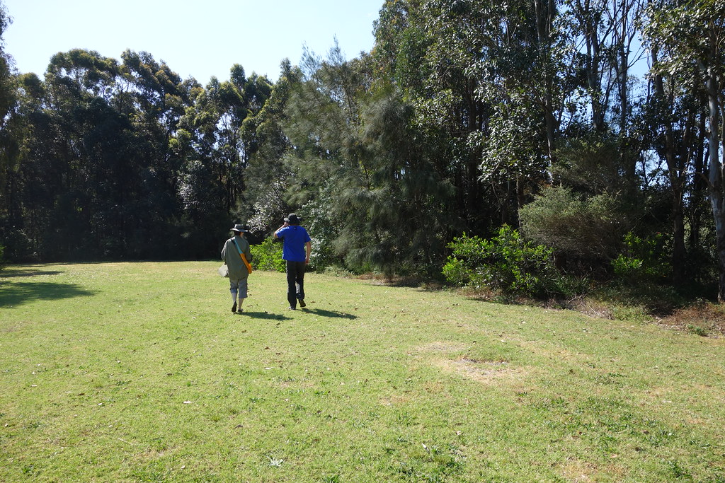
Cath and Brogan forging ahead: Towradgi Creek, October 2014. Photo: Lucas Ihlein

I should have known from the outset that this was going to be a slow walk in which we did not go very far.  First there was the large roll of drawing paper that Kim removed from her bag just at we reached the beach, indicating a significant commitment to mapping the details of our walk.  Then there was the duck’s head poised pathetically on the sand between the mouth of Towradgi Creek and the sea.  The number of photos that we took of this head – before we’d scarcely taken a single step along our journey from sea to escarpment – indicated a through concern with every small, accidental feature of our walk; a concern that would necessarily affect the nature of the walking, slowing it down, shaping it more as a whimsical environmental survey than as a walk.

I should explain that I have nothing against engaging in surveys.  Furthermore, conceiving our project as a series of surveys makes good sense.  If nothing else it is well suited towards producing all kinds of data and artefacts that lend themselves towards being assembled into an art exhibition.  But conducting a survey is not quite the same thing as going for a walk.  A survey may involve walking, but it is not directed towards walking as such.  Walking simply becomes a means of locomotion that assists in making observations and obtaining samples.

My interest and aesthetic commitment to walking is different.  I am interested in it precisely in terms of the tension it engages with processes of representation.   Walking entails a willingness to let things slip by.  I am simply walking.  If I take a photo or pick something up along the way it is always positioned as a brief interruption to a process that entails continuing, rhythmic movement.  On the whole I am more interested in recalling walks than in recording them, and in recalling them I am always aware that the experience of the walk itself escapes.  This is an essential and compelling part of the process.

I must also confess that for me walking is a means of negotiating a relationship between my inner world and the wider environment.  The dialogue this involves is not primarily social.  Very often I go on walks alone.  It is a form of private experience that forces me, at the same time, to engage with aspects of the world beyond myself.  I am very aware of how this corresponds to aspects of romanticism and the dramaturgy of bourgeois identity, but can hardly deny or altogether resist this ideological conception just by acknowledging its historical basis.  This is not to say that I am unwilling to walk with other people.  I often enjoy doing this (and often find myself longing for a companion), but it never quite engages with what captivates me in walking.  My issue then: I must somehow come to terms with walking with other people up creeks.  It is not quite the walking I know.

Actually it is not just dealing with my fellow walkers that is the issue, but also having to engage with the various land owners whose properties abut creeks.  While Kim and Lucas, bold souls, are happy to walk through all manner of fenced and unfenced, dull and fanciful, overgrown and carefully tended creek-side backyards, I am always keen to avoid such trespasses wherever possible.  While they are precisely intent to explore the boundaries between the creek as public property and the uncertain proprietary delineation of a backyard, I am much more focused on discovering the easiest pathway upstream.  The fewer the backyard encounters, the fewer the physical and institutional impediments, the better.  I have no other wish than to flow upstream like impossible water.

I guess a particular problem for me with our current mode of walking is that it does not holistically walk along an entire creek from the sea to the escarpment.  I am aware that our path will often be blocked, that our creeks now are complex spaces involving all kinds of legal, concrete, tin and weed-infested barriers, but I would still like to try to walk their entire lengths.  Our current mode of walking is too slow to accomplish this.  In several hours we managed to walk roughly 1.2 km up Towradgi Creek (shown in orange on the map below).  I’d hoped we’d walk much further than that – to high up in Tarawanna where the creek begins (shown in green below):

towradgi_satellite

So I am proposing another strand of WOTI practice, one that genuinely involves walking (according to my evil and misguided conception of the term) and that may even, at times, involve solo walking events, which will of course be properly described here – demonstrating due regard for the social nature of our project.

I am distinguishing then between two branches of the WOTI project: SWOTI (Surveying Waterways of the Illawarra) and WWOTI (Walking Waterways of the Illawarra).  The latter includes a sub-branch, SWWOTI (Solo Walking Waterways of the Illawarra).  I am aware that these acronyms may confuse project members and participants, as well as the wider public, but believe that they are ultimately useful in terms of designating real differences in orientation and approach.

I would include a photo of the duck’s head, but did not take one.

In Lieu of Walking

I found some links:

  • Here is a pdf of a book on the early settlement of the Illawarra.  Interesting how the focus is mainly from 5 Islands south and how much emphasis is placed on describing places (land allotments) in terms of their bordering waterways – Mullet Creek, Macquarie rivulet, the Shoalhaven river, etc:  illawarra_settlement
  • Found this oral history site on Lake Illawarra (with Warren Burt as VO!)
  • Mullet (the film):

And I had some thoughts:

People living on Illawarra Creeks, risking flooding, land slippage, etc.  Do they do everything to deny their precarious status?  Do they have faith in the the integrity of their land and the contemporary engineering of storm water drains, etc. or do they have an apocalyptic imaginary – stories of rising water levels, of terrible flooding events?  Does the flow of water soothe and reassure them or does it frighten them?  Are they happy with where they are or would they prefer to be elsewhere?  Are they curious about the creek?  Have they wandered its length?  Are they interested in where it comes from and goes?

So we could perhaps consider the variety of ways that people live next to creeks, the ways in which they manage and imagine the correspondence of suburban order and creek-side existence.

Good to attend an auction of an ‘awkwardly positioned’ creek-side house.  How is creek-side identity negotiated, imagined and marketed?  I recall, Lucas, how you thought better of buying a house in Thirroul that was positioned beside a gully/creek and how I have bought a house beside a creek on two occasions, but now, like Kim, live on a slight hill.

As an example of all this, I think of two houses on Collins Ck in Woonona.  The map of Collins Ck suggests quite misleadingly that it stops just a few hundred metres inland:

collins_ck_woonona_map

But the satellite map demonstrates that it runs much further:

collins_ck_satellite_woonona_map

My interest is in the branch that runs to the south just inland of Grand Pacific Drive and then snakes across to the Princes Highway.

On opposite sides of the Princes Highway are two creek-side houses:

collins_ck_satellite_detail_woonona_map

Both properties are run-down.  I am particularly interested in the one labelled Lot B because, unlike the one located on the other side of the highway, it does nothing to separate itself from the creek.  Instead it seems to descend into to it – to have established its identity precisely in terms of being low, dark, green and persistently wet.  The property runs all the way to a turning circle dead end and is completely over-grown and unruly – but people live there, right beside the highway and yet completely immersed in the creek.

Since I lack all social graces, the two of you would be great to tease out the background to this place – to knock on the door and ask how they have come to live in this way.  I even imagine something like a formal sociological survey with multiple choice and short answer questions.  We could ask them, for instance, “From which direction will the apocalypse come?” and “Do you hear voices of despair late at night?  Do they come from the creek?  How regularly?”

Anyway, I offer these thoughts in lieu of doing any actual walking.