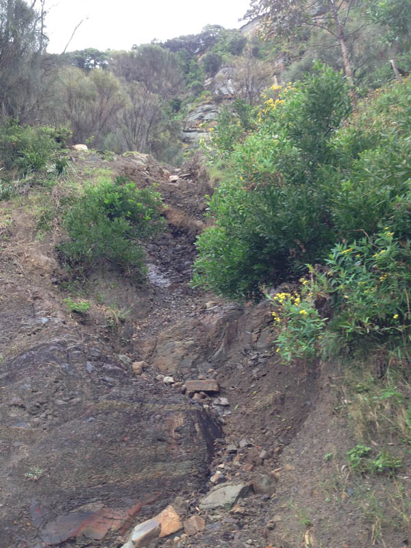
Difficulty: easy down low, though objective landslide risk. Likely to be hard further up.
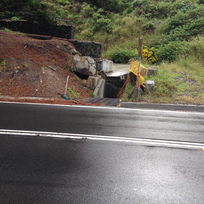
Summary: scarcely a creek at all. A wide concrete sluice, ending at a small drain beneath northern start of Sea Cliff Bridge. Seems to be as much about blocking falling rocks from the road as directing water from the steep slope above.
Directions: park at Leeder Park, Coalcliff. Follow trail from park down across Stoney Creek and then walk up and turn left at Paterson Road. Proceed up to Lawrence Hargrave Drive and turn left on to the start of the Sea Cliff Bridge. Walk along to a small cove with pine trees. The B6 entrance is on the opposite (western) side of the road. Cross the road carefully and walk up a gently inclined concrete floodway/rockfall drop-zone to a steep, muddy landslide creek on the right. 30 minute round trip.
Point of disappearance: the numbered boulders are sufficient to suggest that it is not such a good idea to walk up here. Decide not to ascend the landslide.