All posts by Kim Williams

Wollongong Art Gallery exhibition

opening

Here are some pics of the opening of our exhibition at Wollongong Art Gallery on Friday 27th October. The Welcome to Country was given by Aunty Barbara Nicholson and the opening address by Joshua Lobb. A big thanks to both!

The show is comprised of works generated through the practice of walking upstream along creeks.

Friends have also contributed to this exhibition, including some wonderful photos by Vincent Bicego, who also wrote the catalogue essay, and a video by Hayden Griffith, who deployed a drone and a helicopter as well as on-ground camera work to document the Allans Creek/Byarong Creek system.

exhibition view

exhibition view 2

exhibition view 3

exhibition view 4

exhibition view 5

exhibition view 6

exhibition view 7

exhibition view 8

exhibition view 10

exhibition view 9

joshua lobb

exhibition view 11

woti attendee

woti guest

woti guests

woti guests 2

woti guests 3

woti guest 4

American Creek/Brandy and Water Creek 17/7/2016

Walkers: Shaz, Trevor (Hong Kong), Lucas, Kim

Today we planned to walk a section of American Creek, from the bottom of O’Briens Rd Figtree up to the top of the creek near the Mt Kembla summit.  This involved some elaborate car shuffling: we parked two cars at the Mt Kembla summit carpark, then all got in the third car and drove back down to the bottom of O’Briens Rd.  I chose this section, as I often walk the tracks in Mt Kembla and have been aware of American Creek, as it runs alongside and criss-crosses Cordeaux Rd, which is the route up through Mt Kembla village to the summit carpark.  Also I wanted us to end the day with a walk up the summit track to the splendid vista at the Mt Kembla lookout.

American Creek flows into Allans Creek, not far inland from the steelworks.  Allans Creek is the emptying stream for a number of creeks and it runs out to sea through the steelworks.  I hope we can walk the section between Allans Creek junction and O’Briens Rd in the near future; looking at Google maps, this may involve large detours away from the creek.

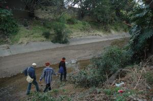
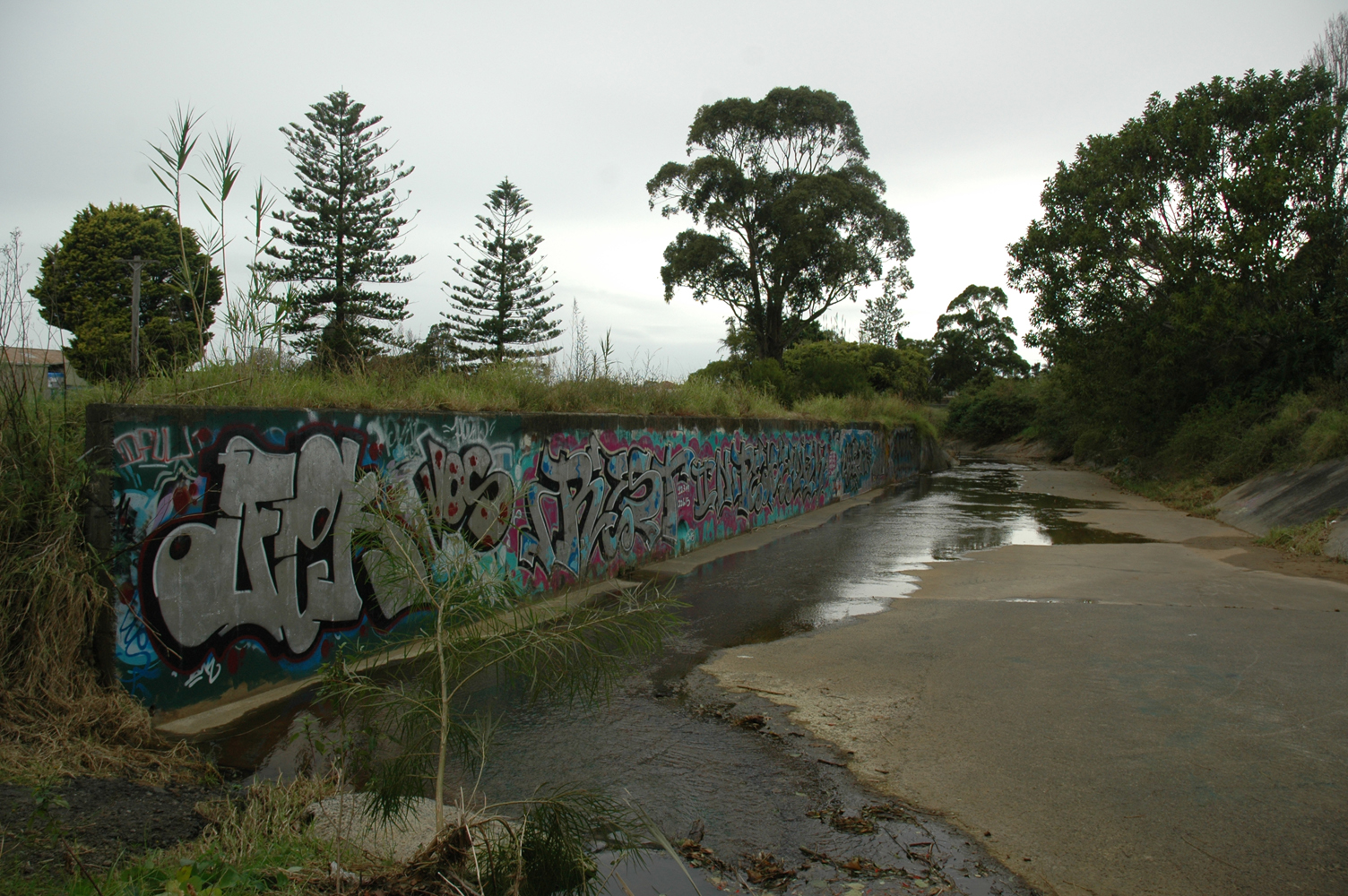
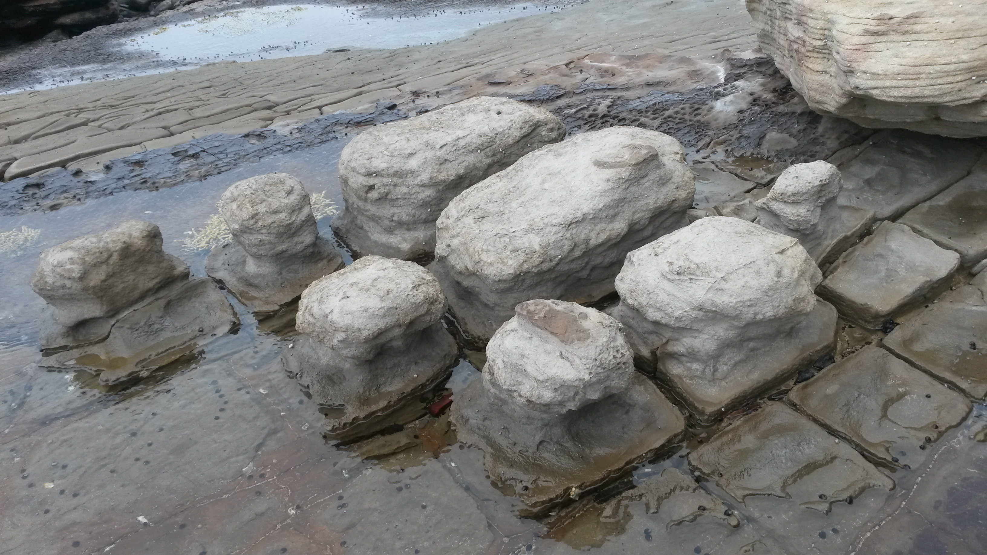
Picking up the creek from the Princes Highway/O’Briens Rd junction, we fairly soon crossed a footbridge to the southern side of the creek.  There is quite a lot of open green space in this section, so the going is easy.   Here the creek is a deep, wide cut through the surrounding land, with steep banks.  At present there is water flowing along the bottom of the creek.  The profile of the creek suggests that there are big flows at times.  It looks like there had been a fair bit of erosion from the recent rains.  There is a distinct floodplain around this waterway and the grass is spongy with damp soil underfoot.

We found a discarded brazier in the bush, so earmarked it to collect on the way back, to be used for Lizzie’s 40th birthday celebrations.  It was in good condition.  Fairly soon our way was blocked by an electric fence bordering a paddock, so we skirted around it, along the back of Figtree Private Hospital.  After walking through the grounds of a nursing home, we were back on the floodplain.  There were a couple of private vegie patches on the floodplain – discreet colonisation of the spacious public land and a practical use of the rich alluvial soil.  A man was tending one of the vegie patches.  It was fenced to keep the feral deer out and it had a charming windmill ornament made from tennis ball canisters.  We stopped to chat and he told us that the flooplain gets a drenching on average once a year from flooding.   He also suggested that we turn along Brandy and Water Creek instead of following American Creek.  In his view Brandy and Water Creek promised a more pleasant, bucolic experience than the suburban environment that American Creek runs through.  He promised that the Brandy and Water walk was also highlighted by a waterfall further upstream, though he had never been there.

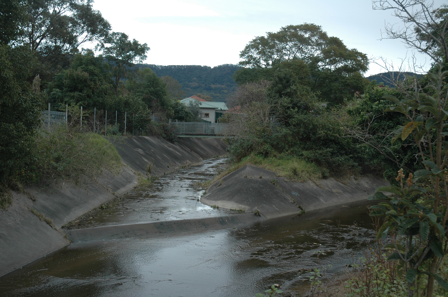
A decision had to be made.  At the junction of the two creeks, Lucas and I played rock, paper, scissors.  This went in favour of Brandy and Water Creek.  We headed north west along this creek, also bounded by fairly open space along its lower reaches.  Soon the creek runs along the back of the hitherto unknown (to me) suburb of Nareena Hills.  The houses are quite large and there is a new development of even larger houses on the western side of the creek.  Trevor, who is visiting Australia from Hong Kong, asked me if the owners of the houses are rich.  I said that they may not be rich, but they would be ‘comfortable’.

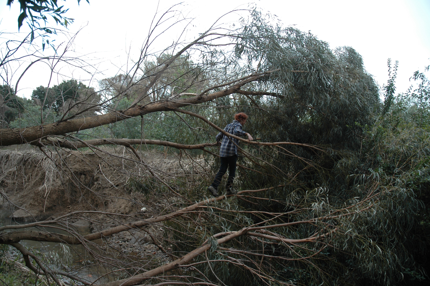
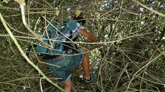
Eventually the open land closed in.  We took a foot track through a thick stand of coral trees and were eventually stopped by the size and number of thorns.  Deer clearly inhabit this area.  Aside from the numerous deer footprints, we encountered the stench and corpses of two deer today.  Brandy and Water Creek, though not without some rubbish and pollution, was in some ways one of the cleaner-looking creeks we’ve walked.

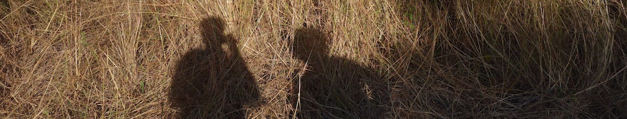
We didn’t reach the fabled waterfall, turning back to make time to drive up to the Mt Kembla summit track and walk to the lookout in the early evening.  The sun was setting, leaving a soft pink hue across the sky over the  horizon.  Lucas wrote a haiku in the visitors’ book at the summit.  We picked our way back down the track in the near dark.


Cabbage Tree Creek 27th June 2016

Today it was Vince, David, Eva and me, walking on a wet Monday.  I had been wanting to walk Cabbage Tree Creek, as it is one of the branches that run off the lagoon at North Wollongong Beach.  In February we had taken the Fairy Creek branch, to the south west.  Cabbage Tree Creek is hard to follow in the first section, as it is contained in a concrete channel which is sandwiched between the Uni’s Innovation Campus and Montague St.  It turns sharply westward at the north end of Montague St, running underneath a bridge.  We picked the creek up by leaving from David’s place in Fairy Meadow, heading across the railway line and over the freeway.

freeway

After skirting around the Fraternity Club and crossing the Princes Highway, we picked up the creek from the Cabbage Tree pub carpark.  At this point the stream looks fairly insubstantial, flowing along the bottom of a large concrete channel.

dropping down to the creek

Like most of the other creeks we’ve walked so far, the creek feels assaulted by human intervention, redirection, rubbish, weeds and general neglect.

channel and graffiti

Not far upstream the concrete stream forks.  We take the right hand fork, as I’m fairly sure that this fork is Cabbage Tree Creek.  David comments that it is liberating to walk without a map.

the concrete channel forks

There is quite a lot of public green space near the creek between the highway and Balgownie.  Strange that it’s recognised as an area for recreation when it is so degraded in the lower reaches.  Yet there are a few areas of bush regeneration.   And of course the obligatory ‘creek loungeroom’.

armchair

As with some of the other creeks we’ve walked in the region, it becomes more creek-like as you walk further upstream.

creek and brokers nose

There is quite a bit of erosion in parts beyond the concrete channel.  It looks like the recent rains may have played a part.

eva walks the plank

birds nest

One of the highlights for me was the green area at the back of a row of houses which has been converted into a creekside recreational space, complete with putting green and outsized golfball sign.

golf

Then the Shetland pony.

shetland

The pony’s paddock blocked our way along the creek, so we had to do a detour on to the streets.  By the time we reached the Balgownie shops we decided to head back, agreeing to pick up the creek again next time at Donnan’s Bridge.

All photos by Vince Bicego.

Fairy Creek post by Laura Fisher Feb 2016

Memories from the creek walk, by Laura Fisher

Being proud of myself for identifying a kangaroo apple plant and eating one, but being very glad to swap that bitterness for the taste sensation of half a passionfruit from the vine opposite, foraged by Lucas.

fairy creek tunnel

The joy of discovering those tunnels, and a few of us briefly trying to harmonise in there. I thought for a moment about the relationship between the graffiti on its walls and the creek walk – two kinds of creative activity that share some kind of illicit (?) quality in public space: hanging out in places we ‘shouldn’t be’.

fairy creek tunnel

Watching Kim attack the lantana. It all had a really adventurous feel, like a Vietnam war movie, until I saw the geometry of the fence through the thicket, and then the romance was over. I still have forearm scratches from my efforts. We talked about needing a machete – I have always been captivated by the sound of the word machete, I think because when I was a kid I never knew what it was but knew it was dangerous.

kim attacks the lantana

There was something very moving about the little camp set up just after the bridge. The way some pillows and belongings were wedged in tree branches created the sense of a tenuous domesticity. When had they been there last, and when would they return?

The rubbish at the beginning part of the river was pretty frightful, I was frustrated to not have a means of collecting it. Next time! Gumboots and gators next time too maybe.

WOTSANOTS

Yesterday Brogan took me on a northern suburbs coastal walk to show me what he’s been up to lately, sneaking off to do SWOTI walks (Solo Waterways of the Illawarra).  So I dismantled that acronym by joining him.  It was a wonderful walk that I’ve never done in all the time I’ve lived in the Illawarra: picking our way along the rock platforms and scrambling around the rocky headlands from Coalcliff to Wombarra, then back along Lawrence Hargrave Drive above the cliffs.

Rock shelf and bridge pylons
Rock shelf and bridge pylons – Brogan took this photo previously

The outward journey is spectacular and  beautiful in parts.  Looking skyward to see the underbelly of the Sea Cliff Bridge, coming across small waterfalls pouring down rocks to the beaches, densely vegetated gullies, thick seams of coal banding the cliff walls and of course the pounding sea and stiff southerly pushing against our flesh.

rock formations
rock formations

Wollongong’s mining history is here too: abandoned mineshafts nestled in the rock and old bits of wood and rusted metal which were once part of the Clifton jetty structure.  I’m guessing it was used to transport the coal by sea directly from the mine.  One fascinating building, decidedly more contemporary, is a small rusty tin shack tucked into the scrub above a beach.  Sort of like a fisherman’s dugout with door, plywood floor and storm window, but on closer inspection an apparently handy site for sexual exploits, with a fully illustrated account written in texta on the door.

Brogan and the hut
Brogan and the hut


brogan in the hut 1
Brogan in the hut

Brogan marked the waterways he thought noteworthy on a topographic map.  This area is so steep that the sight of water coming off the cliffs is common; whether it is coming from a small creek or just seeping from the vegetation on the clifftop is often hard to tell.  Once you get up to the road these waterways are often obscured by houses.  They are directed eastward by culverts, pipes and drains, while westward they disappear under driveways and lawns, or sidle along gardens.

This brings me to the title of my post, WOTSANOTS.  This acronym signifies a one-off splinter activity: Waterways Of The South And North Of The State.  The challenge of this activity was to document all named waterways on the road trip I did out to Broken Hill and back recently.  The journey out went via the southerly route (there is no direct route from Wollongong to Broken Hill), through places such as Wagga Wagga, Hay, Balranald, Mildura, Wentworth, then up to Broken Hill.  I deliberately made this trip a circuit, returning on the northerly route via Wilcannia, Cobar, Nyngan, Dubbo, Bathurst, Katoomba then Wollongong.   With a little notebook, I recorded each creek name while driving (not a recommended practice) and ended up with one hundred and thirty three names.  This required some alertness, as it is easy to lapse into reverie when driving such long distances and to forget to observe closely.  There seemed to be a fairly even spread of Aboriginal and non-Aboriginal names to these creeks and rivers, some with delightful titles such as Talyawalka Creek, Run O’ Waters Creek, Poison Waterholes Creek, the Bogan River and my personal favourite, the Great Darling Anabranch.

Many of these creeks were of course dry.  I was struck by two things: on the journey out, there were far more creeks in the first part of the journey where it’s hillier.  This made sense to me, as the Great Dividing Range would surely generate many waterways.  Yet on the way back, heading east from Wilcannia, there were many named creeks (completely dry) in the very flat western landscape.  This made sense too in its own way, as these creeks are part of the Darling River floodplain area and would all be activated by floodwaters flowing down from the north.

Walking Upstream – WOTI walk #2

SAM_2577 SAM_2580

Brogan wasn’t available today, so Lucas and I resumed the exploration of Hewitts Creek in Thirroul.  We started from the mouth of the creek at Macauley’s Beach again.  As we crossed the footbridge over the creek to begin the walk, we came upon a large group of walkers who had ambled from North Wollongong to Thirroul.  We ended up in a conversation with a fellow from the group.  He had a GPS in his hand and was quite excited – he explained that cartographically, the earth is divided into grids of 100 square kilometres and that it just so happens that the grid line which is the 00 easting coordinate intersects with the footbridge about two thirds of the way across the bridge.  It was a momentous occasion for him, so we watched as he passed this significant point on the earth’s surface.  Who would have thought? Continue reading Walking Upstream – WOTI walk #2